For latest Los Angeles Real Estate Neighborhood Updates, click here.
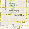
Hancock Park / Windsor Square »
A lush oasis between the financial centers of Downtown and Beverly Hills and Century City.
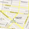
Carthay Circle »
Roughly bounded by Wilshire Boulevard on the north, La Cienega Boulevard on the west, Pico Boulevard on the south, and Fairfax Avenue on the east. Principal thoroughfares through the district include San Vicente, Olympic, and Crescent Heights Boulevards.
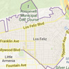
Los Feliz »
Home to some of the more interesting residential architecture in the city, including two homes designed by Frank Lloyd Wright: Hollyhock House and the Ennis House.
Melrose Hill »
A quaint neighborhood of 42 historic homes located near the intersection of Melrose and Western avenues in southeast Hollywood.
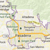
Pasadena »
Located in the northeast corner of Los Angeles County sandwiched to the east of Burbank and to the north of downtown Los Angeles.
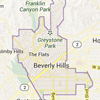
Beverly Hills »
This world-famous neighborhood developed in the late 1920s and early 1930s after Hancock Park as Los Angeles grew west.
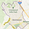
Brentwood »
Located at the base of the Santa Monica Mountains, bounded by the San Diego Freeway on the east, the city limits of Los Angeles on the southeast, Wilshire Boulevard on the south, the Santa Monica city limits on the southwest, the border of Topanga State Park on the west, and Mulholland Drive along the ridgeline of the mountains on the north.
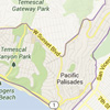
Pacific Palisades »
Located along the beautiful Pacific Coast between Santa Monica and Malibu, the Palisades is often referred to as the “Hancock Park by the Beach” as it is one of the LA neighborhoods with the strongest community feel.
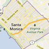
Santa Monica »
A costal community which borders the Pacific ocean on the west, Pacific Palisades and Brentwood on the north, West Los Angeles and Mar Vista on the east, and Venice on the south.
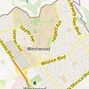
Westwood »
This neighborhood is best known as the home of the University of California, Los Angeles (UCLA).
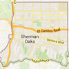
Sherman Oaks »
This neighborhood is close to two major freeways and serves as a gateway from Los Angeles to the San Fernando Valley.